Yesterday instead of going out for a walk I added walking trails to OpenStreetMap. The trails are up at Stony Lake, northeast of Peterborough, Ontario. They’re managed by Kawartha Land Trust, who are doing really important work in preserving the natural heritage of the Kawarthas. The KLT has many protected properties, but the one I know best is the Stony Lake Trails, a network of walking paths through KLT property, public roads and even private property where the owners have generously allowed access.
Here’s what the area looked like before in OpenStreetMap.

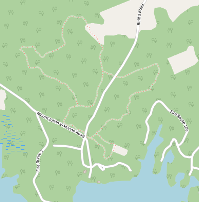
Here’s a close-up of the promontory on the left. There are some roads at the bottom. That’s Viamede, a popular resort with a hotel, some cottages, a pub and Mount Julian, a restaurant with a great cook who does tasting menus (with things raised and grown locally, sometimes just a few meters away) that are absolute delights.
Above the roads at the bottom, on either side of the road going north, there are some faint lines. That’s the Blue Trail, which I added last year. It’s the easiest of the Stony Lake Trails to get to, and it has the best moss. But at the time it was the only trail where I’d recorded my tracks, so I couldn’t do the others.
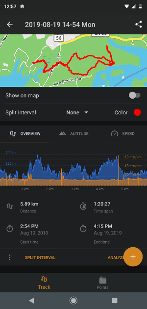
Last summer I walked the Yellow, Brown and Red Trails and recorded my tracks in OsmAnd, the Android mapping and navigation program that uses data from OpenStreetMap. I walked them all together in one afternoon. (At the time I thought it best to record the different trails separately, but that just made slightly more work for me. I should have just turned on tracking, walked all the trails, including the back-and-forth of sometimes retracing my steps, and saved everything in one file. It would have saved a few minutes.)
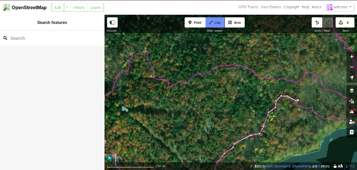
On the right is the recorded track of the Red Trail. I started at the left, walked east through wetlands (the trickiest part of the trail), then across a road and I took the southern half of the circular trail. There’s a line that goes north, which is where I wasn’t paying attention and walked for a while up a road that looked like it was part of the trail but wasn’t. Now that the trail is in OpenStreetMap no one else needs to make that mistake! I walked back, got on the correct path, and went west where I met my previous path and returned.
The tracks were recorded as GPX (GPS Exchange Format) files, which look like this:
<trk>
  <trkseg>
    <trkpt lat="44.5673474" lon="-78.1291117">
      <ele>215.742</ele>
      <time>2019-08-19T20:17:05Z</time>
      <hdop>3.216</hdop>
    </trkpt>
    <trkpt lat="44.5673486" lon="-78.1291602">
      <ele>212.996</ele>
      <time>2019-08-19T20:17:10Z</time>
      <hdop>4.288</hdop>
      <extensions>
        <speed>1.12</speed>
      </extensions>
    </trkpt>
  </trkseg>
</trk>
There’s a track, and track segments within it, and the points are noted with latitude, longitude, elevation and a timestamp. HDOP is horizontal dilution of precision. You don’t need to know the details, though. This is just how to get the data out of OsmAnd and into another map.
You can upload these to OpenStreetMap as GPS traces. There are various privacy options. I made these public and identifiable.
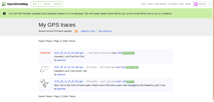
Shortly after you get an email to say the track has been processed and is viewable. Click on the edit button and you see something like this.
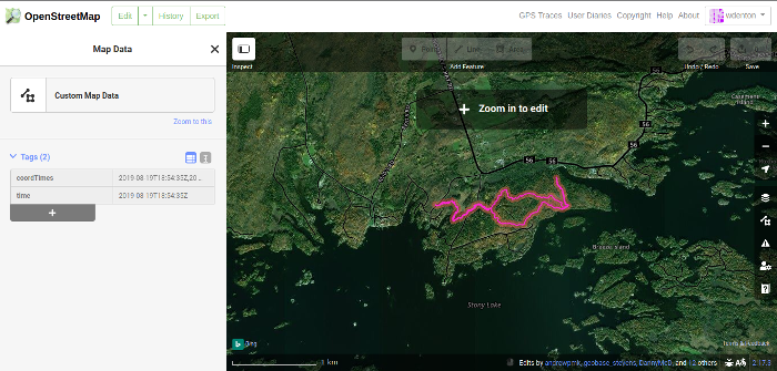
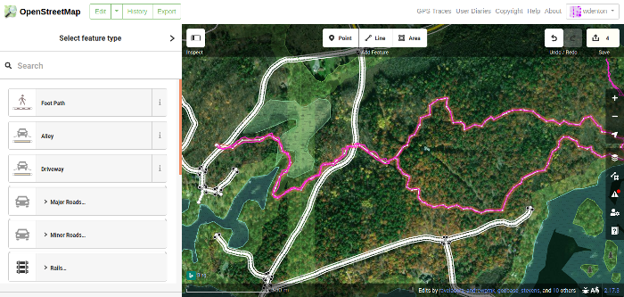
The trace isn’t turned into routes on the map. To add the walking trails, I had to create a new line in the editor and go click-click-click on top of my trace, adding the line point by point. I clicked on the line option at the top to start. I think it’s Ctrl-click with the pointer to make the first point, then it’s just move and click. At the end of the circular part I clicked onto a point I’d made earlier, and then Esc got me out of editing the line.
Once finished, the new line looked like this. I changed the type to Foot Path (highway=footway) and added some metadata.
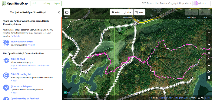
The editor pointed out a few minor problems with what I’d done, such as where the trail crosses a road. It asked if the trail was tunnelled under or was a bridge over the road, because it doesn’t like one line right on top of another. I need to see how to handle this case properly, and then I’ll go back and correct it. I also need to find out how to handle the case where the walking trail goes along a public road for a short distance.
With all that done, I saved my work and committed it.
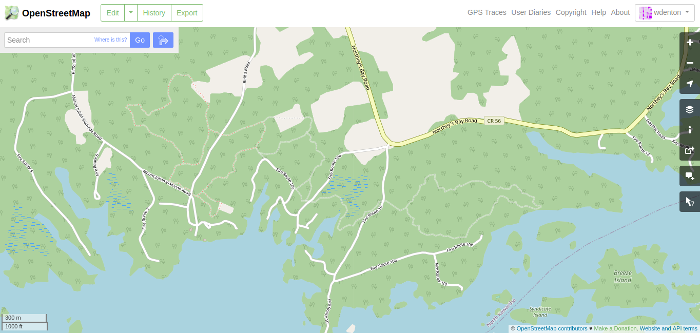
A few hours later, this trail and the others I’d added appeared on the map (note the new faint lines—zoom in OpenStreetMap itself to see them up close).
I did all this to make my own walks easier and so that the geodata is now openly available. The KLT has a Stony Lake Trails overlay in Google Maps, nice work done by students at Fleming, but that trail data isn’t actually part of Google’s data, as far as I can tell. Anyway, I don’t use Google Maps, and I want the trails in OpenStreetMap where anyone can use the data. The KLT also has a PDF map you can download from the Stony Lake Trails page, and I’ve taken it with me on paper many times, but it’s important to be able to locate yourself directly on a map and know if you’re actually on the trail you want to be on.
I hope to walk the trail this summer, and I’ll check OpenStreetMap as I go.